Saturday, July 17, 2021

GRUSK Venti: The Conclusion

If you have not already read about the start of this adventure, please read about Day 1 here and Day 2 here.

So many chickens.  And one very loud rooster.

Roosters are assholes.  That being said, Friday night's sleep was one of the best I have ever had.  After reading for a bit, I fell asleep and slept like the dead until about 01:00, at which point I had to pee.  (Do you sense a pattern?)  I got up and out of the tent and happened to glance up towards the sky.  The STARS.  So many stars.  There were no lights and minimal clouds, so all you saw were billions upon billions of stars.  It was breathtaking.  I almost took off my rain fly after that so I could just fall asleep (with my glasses on) staring up at the immensity of space.  But, I was not sure about the weather, and would have hated to wake up to raindrops on my head.  So, I crawled back in my tent and threw some earplugs in and went back to sleep.

Even with earplugs, I still was woken up about 04:30 by our new friend Colonel Chicken Fingers crowing.  Ugh.  I forgot how annoying roosters can be.  Luckily, he quieted down after a few minutes and I got another hour or so of sleep.  I woke up a little after 06:00 and heard that Laurie was already up and breaking down her camp.  I started doing the same and got dressed in a nice, clean, dry, new kit.  This was probably the most exciting thing of the morning.  Day three always gets a new kit, and that day, I REALLY needed it.  The two previous days of rain and sweat had created a little more...  friction...  than I was used to.  Needless to say, I did not bring enough chamois cream.  Oops.

This little honey bee was pretty excited about the good vibes from my gloves.


We ate a quick breakfast, washed up, and packed our bags.  We said goodbye to our host more than once (seriously, you should definitely make this B&B your next weekend getaway!), said good morning to a lovely little honey bee (that did not try to sting me!), and chatted with our new Italian friend for a few minutes before heading off.  

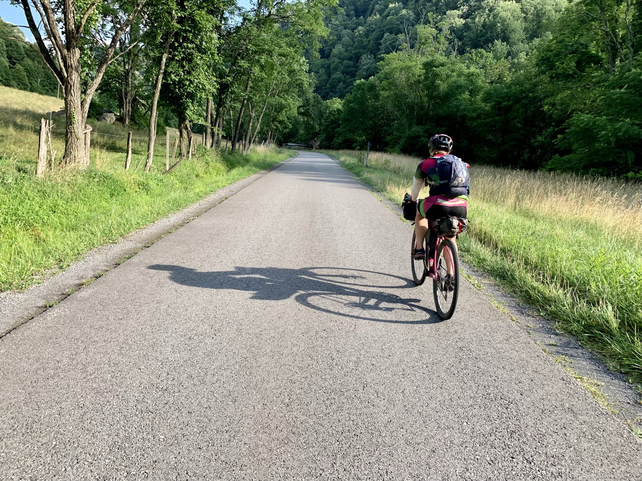
We had an idea of what was coming...  We knew that we had to climb out of the river basin, but in all honesty, I did not look at the elevation profile that hard.  So we started out on a smooth paved climb.  And we climbed.  And we climbed.  And we just kept climbing.  I kind of figured it would be a long climb, but after about three miles, I finally gave in and looked at the elevation profile on my Wahoo.  I even zoomed out, but it just looked like a wall.  A never ending wall.  

So we kept climbing.

One of the very short low grades on our
12 mile climb out of the river basin.

After a bit, my knee started to remind me that it had been seven weeks since I tore my MCL.  Just a little poke...  "Hey there brain....  remember me?  Your right knee?  I am not too happy, you might want to scale it back a notch..."  So, I eased off a bit.  I had gotten a bit of a gap on Laurie, and she quickly closed it and kept climbing.  I kept climbing, too, just at a slower pace.  My knee breathed a sigh of relief and kept quiet for a little longer.

Smile through the pain.

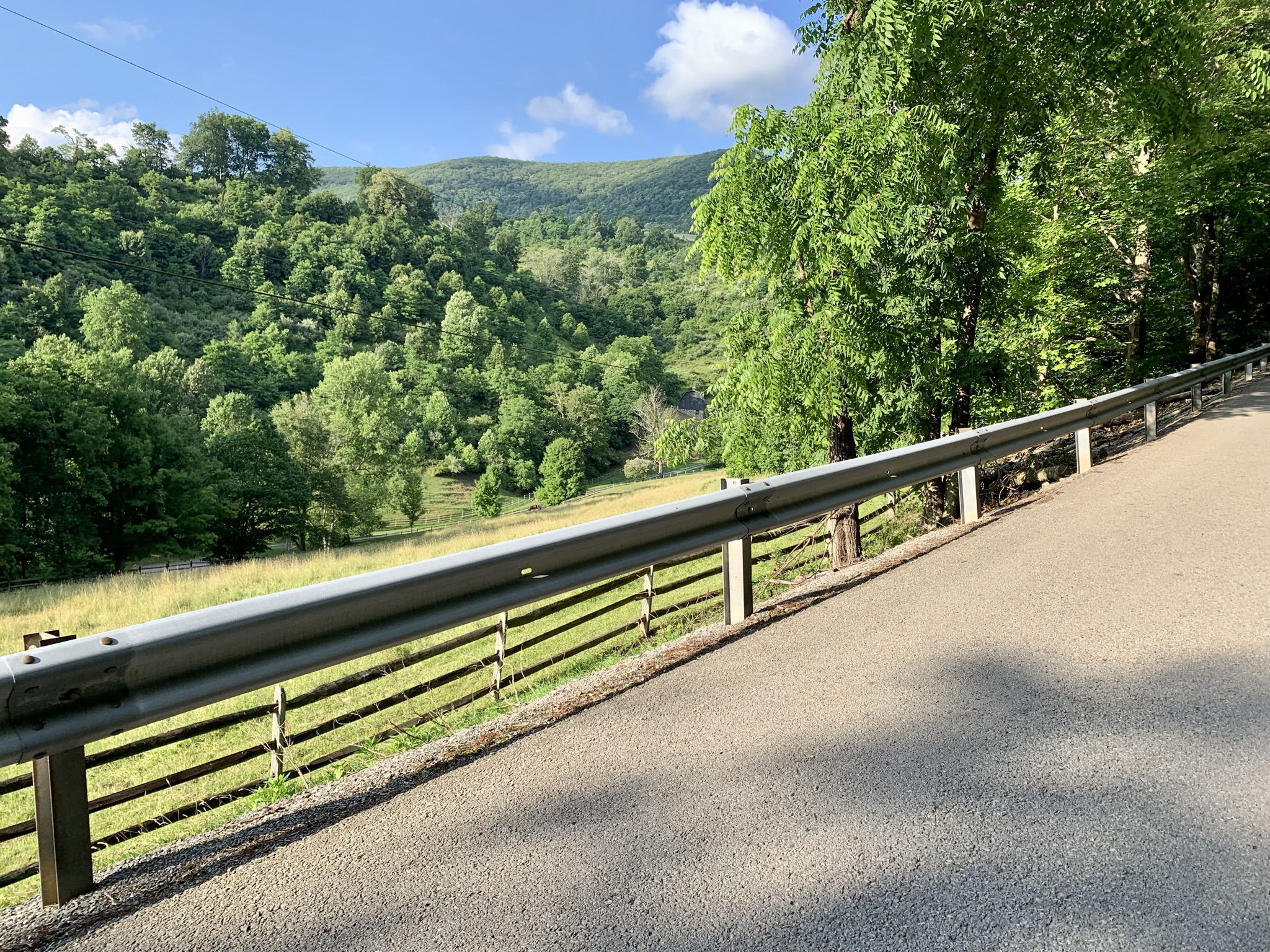
The nice smooth pavement climb suddenly turned into a worn out farm road complete with ruts, rocks, and more climbing.  Luckily, we dived into some lovely wooded areas and left the blinding sun behind for a bit.  Which, do not get me wrong, I was pretty excited to see the sun, since it had rained the majority of the past two days.   But it was bright and a little warm on the climbs when we were exposed.  The shade is much more conducive to climbing.  

After about 12 miles and 2 hours of climbing, we finally hit a nice little descent that took us to Route 33.  We stopped at the intersection and had a nice little snack break, getting excited that we were done with the majority of the first section of climbing for the day.  I briefly looked at the elevation profile on my Wahoo and saw a nice downhill section, so I told Laurie that at least the section of Route 33 was downhill.  This is important because Route 33 is a very busy road with a 55 mph speed limit and only a very small shoulder.  I figured that we would be swift on the downhill and get off the anxiety inducing highway quickly.  

Well...  Someone should really zoom out when looking at the elevation profile.  Because only the first third of our section of Route 33 was downhill.  The rest was a 1.5 mile 8% slog up the mountain.  With vehicles whizzing by VERY closely.  It was terrifying.  But we made it up and off 33 as quickly as our tired legs and angry knee would let us.

And then we descended.  It was fast, breezy, and exactly what I needed.  I knew this was the last descent before we started the 25 mile climb that would ultimately get us to the highest point in West Virginia.  Unfortunately, the descent was only a mile and a half long.  But it was long enough to dry some of the sweat and put a huge grin on our faces. 

WE ARE GOING TO MAKE IT!

The next bit was a lovely paved road with just enough of a grade to make you pedal.  But we were making good time and enjoying the scenery.  Lots of open space, some farms, mountains around us.  It was everything you could wish from a low grade, steady climb on pavement.  

Just keep spinning, just keep spinning!

As we pass through Whitmer, we realise that Laurie is getting a little low on water.  We stopped at a church, thinking there would be a hose bib outside that we could use, but a cursory search yielded nothing.  I knew that Ruby's tackle shop was just ahead, so we decided to carry on and stop there for a refill.

We pull into Ruby's and luckily, the sign indicated she was open.  There was another sign on the door that asked patrons to please wear a mask (for those reading this far into the future, this was during the COVID-19 pandemic).  Laurie had forgotten to bring a mask, but I had one buried deep in my feed bag.  So I dug it out and went inside in search of water and salty snacks (see, theme!).  

I looked around, and it took a minute for me to register that Ruby was sitting down in a recliner in the corner.  She got up and immediately went into grandmother mode.  She is the sweetest thing.  She got us some water, offered to open a full size bag of chips for me (I refused, that would have been silly), and made sure we had everything we needed to continue on.  That woman is an absolute godsend.  If you ever happen to be out her way, stop by and say hi.  

All smiles as we get ready to leave the pavement behind
and continue towards the Spruce Knob summit.

We filled up and continued on our way.  The lovely mildly graded paved climb eventually turned to gravel and meandered along the Cheat River.  This is one of my very favourite roads in West Virginia because it is so pretty and is such an understated climb.  I knew that from this point we had about 20 miles to go to hit the summit and about 11 miles to hit the race day aid station.  I NEEDED those salty snacks.  

On this section of Whitmer Road, there are tons of fishing spots, primitive campsites, swimming holes, etc.  So, we definitely ran into several cars, some friendly folks, and even a couple of dogs.  Everyone was so polite.  One truck with Florida plates even apologized for the dust as they passed us.  There were smiles and waves all over the place.  

We stopped at a forest service bathroom (it is just a chemical toilet, no running water) for a quick break and to stretch our legs before continuing on the climb. Here is where I realized that I was out of chamois cream.  My saddle sores seemed to have saddle sores.  For the past 10-15 miles, I had been shifting around as much as possible on the bike to alleviate the friction and pressure.  But since the grade was so low, it was pretty difficult to stay out of the saddle for more than a few seconds at a time.  Both of us commented on how we wished the grade were a bit steeper so we could spend more time out of the saddle.

Luckily, Laurie had one packet of chamois cream left, so we split it.  It was heaven for about a mile, then things went right back to feeling like sandpaper.  Note to self, bring two packets of chamois cream per day and USE THEM next time.  Some lessons are learned the hard way.  This is one of those lessons, since I normally never use chamois cream.  But the rain and sweat definitely did a number on me.  

The road did eventually tick up a bit in the steepness department.  This was a relief from a saddle perspective, but my knee kept reminding me that it was there.  I was having some internal conflict about whether or not we should head up to the summit or if we should cut the course and head back to the venue (this was an option that would have knocked about 12 miles off the final mileage tally and cut an hour off the time that it would take for me to get to beer at the venue.  

BUT...  I really wanted the redemption of finishing this race.  So I just kept slogging along and debating with myself.  About the time that I was ready to throw in the towel and tell Laurie that I had decided to skip the summit, we saw the sign that indicated we were about to turn onto the main race course, which meant that salty snacks were only a couple of miles ahead!

And low and behold, but who shows up at that intersection the moment we ride up?  Travis Olsen himself.  He stopped, grabbed a photo of us, and made sure we were in good spirits.  He told us to just keep on spinning and he would see us at the finish in a couple of hours.  That was just the motivation that I needed.  I felt a little fire in my legs and I told myself that we were so close, I just needed some salty snacks.

That two miles to the aid station just about killed me.  I was aching in so many places.  My back, my shoulders, my saddle sores, my knee.  Even my arms were sore.  Everything was complaining about 200 miles in the saddle and so much climbing.  But we were so close.  We passed the sign that said Aid Station 1 Mile and I almost cried.  

I can go one more mile.  I CAN.

When we pulled up to the aid station, instinct took over.  I leaned my bike against the guard rail and waddled over.  I immediately took a shot of pickle juice.  It was just as gross as I remembered it being, but boy, did it do the trick.  After about a minute or two, my legs started feeling less heavy.  I ate crackers and cheese, chips, pringles, more chips, Doritos, and grabbed another packet of crackers to eat later in case I needed more salty goodness.  I drank some gatorade (which is also just as gross as I remembered it), went back for more chips.  It was glorious.  

Laurie, by this time had gotten her fill, gotten back on the bike, and was ready to go, thinking I was right behind her.  She looked over and saw I was still stuffing my face.  Sorry about that.  I needed fuel.  

We had about a half mile or so to go before the split to make the decision whether to keep on course up the mountain or cut it and head back.  Laurie knew that her husband and stepson were about 45 minutes ahead of us, so we had the chance to catch them as they were coming down from the summit.  Seeing people and eating ALL of the food had energized me.  And I really REALLY wanted redemption.  So I made the decision to go all in and if worse came to worse, I could turn around and head back.

So we climbed.  

We got passed by a few fast friends as they were climbing and finishing up their races.  Harlow, Jen, Cara and others.  They all cheered us on and told us we were crazy for climbing the summit on fully loaded bikes.  Full disclosure, we thought about ditching some of our heavier gear before heading up, but decided it would a) not be worth the hassle and b) would not exactly be in the spirit of bikepacking.  

We did see the boys as we were climbing, so we stopped for a moment to chat and say hi.  They were in great spirits and were pretty stoked to cross paths with us.  That moment made the climb worth every agonizing pedal turn.  

The last push up to the summit is paved.  It is also steep with a little psych-out descent in the middle.  My knee was pretty close to yelling at me here.  So, I eased off and spun up the climb to take some pressure off.  Laurie was looking strong up the climb, but she eased off a bit too so that I could catch up.

And finally...  After three days, 200 miles, 20,000 feet of elevation, we were at the highest point in West Virginia.  Welcome to Spruce Knob.

WE MADE IT!!!

I was STOKED.  We were going to finish this thing!  And it took less time than I expected to climb to the summit, so we were going to get to beer sooner than I thought.  Oh yeah!   

So we made the little circuit at the top, had another shot of pickle juice (ICK!) and headed down the mountain.  

The best thing about this race is that the summit is an out and back.  So you get to see folks as you are climbing up and heading down.  We did not see too many folks on the way up, as we were near the front of the races.  But on the way down, we got to see a steady stream of friendly faces.  Calling out to people that you know as you bomb down the mountain (or climb up) is some of the most fun I have ever had.  So thanks to everyone that said hi as we flew down. 

The last bit of the course is mostly downhill.  There are a couple of smaller climbs, one of which is notorious from 2019 where my rear derailleur seized.  While climbing it this year, I kept reminding myself that at least I was on my bike and not running in bike shoes to the finish.  I also kept reminding myself that we only had a couple of miles to go, so just keep spinning!

Adrenaline kicks in when you know you are so close to the finish.  Laurie and I both kicked it into high gear as soon as we turned onto the road to the finish.  

JUST GET IT DONE.    

My knee was starting to protest again, but I really wanted to just get off the bike, so I pushed on.  Half a mile to go.  

JUST GET IT DONE.

We heard some cheers as we rounded a corner and Laurie's husband was on the side of the road cheering like a mad man.  It was heartwarming and gave me the last little push that I needed to finish the climb and turn onto the grassy descent to the finish.

WE WERE DONE!

Laurie and I crossed the finish line together.  I think we tried to high five or hold hands or something, but the fact is, we finished and we finished together.  

There was a lot of emotion as I crossed that finish line.  The one that was most up front was relief to get off the bike and not have to sit on a saddle for a while.  The next one was pride.  Seven weeks ago, I started out to complete a similar race with high expectations but was sidelined 130 miles into the ride with a torn MCL.  I was devastated, and that was even before I knew the extent of the injury.  I worked so hard to rehab that knee, doing everything the ortho and PT advised.  I even started taking rest days!  (Rest day, what is that?!)  So to finish GRUSK in relatively good shape AND with one of my best friends.  

That is a victory any way you look at it.  

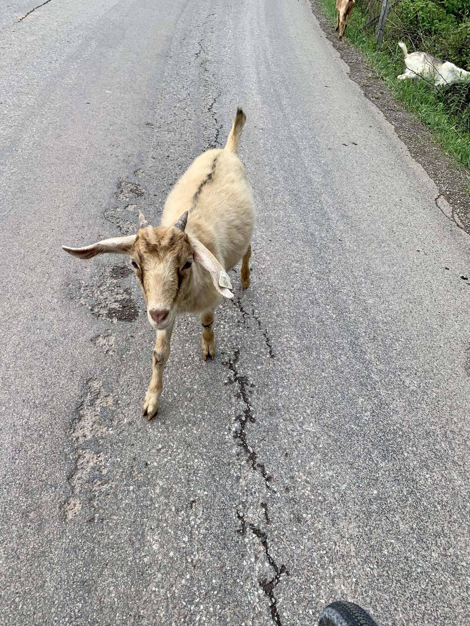
Sure, I took a little longer than I wanted to, but we got to enjoy the ride instead of racing towards a finish line.  Otherwise we would not have stopped to pet goats, see waterfalls, chat with locals, get stung by bumble bees, or have pizza and beer with new bike friends.  

It was the best kind of adventure.  


GRUSK Venti: Day 2


If you have not already read about the start of this adventure, please read about Day 1 here.

Settle in, friends.  This one ended up being longer than I anticipated.  Cheers!

The view before dark.

Crawling into your cozy tent after a hard day's ride and a good meal is one of the best feelings in the world.  Laurie and I settled into our tents and I fell asleep almost immediately.  Only to be woken up not an hour later by a vehicle coming up the dead end road that we were camped on.  Bickle Knob has an observation tower, which I knew was probably pretty popular during the day and around sunrise and sunset.  However, I assumed that during the dark hours, no one would bother with it, since you know, you can not see in the dark.  Well, apparently I was wrong.

The first vehicle that came up apparently had two adults and two younger teenagers.  The adults stayed at the truck while the kids ran up to the tower.  They were relatively quiet and did not stick around long.  Figuring that might be it, I settled back in to try and go back to sleep.  Well, about a half hour later, another vehicle turns up towards us.  This time, I turned the light on in my tent to let them know they had woken us up.  The stuck around in the parking lot for a few minutes, then rolled on.  At this point, it was about 01:30 or so and I had to pee.  So, I got out of my tent and used the "bushes" and then crawled back in.  Not 10 minutes later, I hear the music before I hear the crunch of the gravel.  Someone is blasting Sweet Home Alabama (or some other such southern staple) and hootin' and hollerin' like crazy people.  

It is 02:00...  What is happening?  Luckily they are super loud, so I know they really do not mean us any harm.  But oh my gosh, they are loud.  And apparently VERY intoxicated.  I tried to remember back to my high school days (as these kids could only be under 18, no one in their right adult mind would be that blitzed, that late, driving, on a Thursday night) and remember what it was like.  I tried not to be too annoyed, because growing up in a rural area, there really is not much else to do.  Granted, we tended to gather in empty fields and stayed there and not drive around on forest roads in the middle of the night drunk out of our minds....

Big wall of text, here have another goat!

These kids were noisy, drunk, maybe high on something, and just plain annoying.  I was a little worried they were going to get violent with each other since there was a lot of arguing, but in the end, they finally got back in their vehicle and left.  It was 03:00... 

It took me about half an hour to relax enough to get back to sleep after that.  I was pretty confident that they were going to be the last visitors until sunrise, which was not that far off.  Luckily, I woke up about a half hour before sunrise to pouring rain.  AHH!  Thank goodness, no one else would head up to the tower, so I could get back to sleep.  

Since we climbed up to the ridge the night before, we could get a leisurely start to the day, which was good, because it rained until after 06:30.  We both stayed in our tents until the rain cleared out.  But when I poked my head out of the tent, I was shocked.  The world was blanketed by a rich, white layer of fog.  It was magical.

Rain jacket on to fight the chill on the five mile descent to the river.

We took our time making breakfast and packing up camp, hoping that the fog would lift a bit so we could enjoy the descent down to the river.  We were running a little low on water, but knew there was a campsite at the bottom that should have a water spigot, so we were not too concerned.  A bit before 08:00, we were packed up and ready to head down the mountain.

One last look at our beautiful overlook.

The fog cleared out about halfway down and the descent was an absolute glorious start to the day.  The gravel road was well maintained and had very few potholes or washboard.  Plus, the rain had turned everything into a fresh green landscape for miles.  It was beautiful.  

We cruised down the mountain and hit the road that should have had the campsite with water.  We found the campsite, but there was no water.  We opted to keep rolling, since we knew if we kept going down, we would eventually be on the same plane as the river (currently the river was about 300 feet below the road we were on).  It was mostly down hill and we both had a few sips of water left.  It was quite interesting though, because on the east side of the ridge (where we had climbed up the day before), there water was incredibly plentiful.  On the west side, it was dry as a bone, even though it had just rained a few hours before.  Even the ditches were dry.  It is so interesting how things change on one side of a mountain to the other.

As we close in on the river, we pass by this really lovely house that I wish I had taken a photo of.  It was stunning, with meticulous landscaping and flowers galore.  By the time we had passed it, we found a road that would take us next to the river so we could filter and fill up.  We spent a few minutes next to the river, where of course, it started to rain again.  Either way, it was a nice break from coasting downhill!   

Filtering water next to a lovely river is such a chore...  

The next 15 miles is along one of the loveliest roads I have ever been on.  Shavers Fork Road winds along what becomes the Cheat River and is rolling gravel, mostly downhill.  It is raining a bit as we snake along the river enjoying the views and the descent.  Unfortunately, I was enjoying the descent so much that I failed miserably at taking photos of the beauty that was surrounding us.  Needless to say, there was an amazing amount of lush green with pops of white and purple rhododendron blooms.  The gravel was well maintained and allowed us to keep up a pretty decent pace.  

After a bit, I got a little hungry, so we stopped to have a quick snack break.  As we were stuffing our faces, Steve and Cassie rolled up and ended up stopping with us.  They had spent the night at the venue director's house and had to climb up the ridge this morning.  They were in great spirits and were really looking forward to rolling into Parsons in a few miles and grabbing a bite to eat at Subway.  (I never knew anyone so excited to eat at a Subway!)

The four of us rolled towards Parsons together, when all of a sudden the beautiful gravel road turned to the smoothest pavement any of us had ever ridden on.  Unfortunately, as it turned to pavement, the road took a very quick turn upwards.  Even though it was not THAT steep, after the rolling descent we had been on, my legs almost immediately felt like lead.  Oof!  That was tough.  THEN...  get this, all that climbing that we just did, we immediately went right back downhill into Parsons.  What was the point of all that?

Steve and Cassie peeled off and stopped at Subway.  We rolled a little farther (like literally 150 feet) to the tiny little grocery store to top off our water, grab a salty snack, and get some batteries for Laurie's SPOT tracker.  Laurie looked longingly at the banana table, but all the bananas were green.  (I, personally, prefer green bananas, but I am also allergic to them, so...)  We hung out outside the store for a minute so I could eat my body weight in salty chips and Laurie could swap out the batteries in her tracker.  

Apparently we piqued the interest of one of the cashiers and she came out on her smoke break to chat.  She was a super sweet young woman who seemed pretty impressed that we were out adventuring on our own.  She also seemed terrified for our safety, as she was listing off some other pretty cool adventure places in the area that were not on our immediate route, she mentioned Dolly Sods.  Now Dolly Sods is a pretty well known wilderness area in the National Forest that we were traversing.  Lots of folks hike and camp in the area and it is known to be absolutely beautiful.  Our young cashier, however, had a different take on it.  She warned us to not go in the back way and stay on high trafficked trails, since there have been bodies found out there.  Luckily, there was a big black rain cloud heading in over the mountains.  So we smiled and nodded and thanked her for the information and set out on our way.  

We stopped by a really nice park on the way out of town to use the bathroom and wash our hands/faces.  Camping and gravel grinding gets a little grimy.  Then we set out to climb back out of Parsons, which apparently just sits in the Cheat River basin and you must climb to get in or out of it.  Or, I guess just cross the river, as apparently there is a bridge.  The next little bit of road goes by easily enough.  Until we get to a bridge that we must cross to get into the town of Hendricks.

As we approach the bridge, we see that Steve and Cassie are already crossing it.  They both look like they are taking very cautious steps, so I get a little worried.  Then I get up to the bridge and see the sign.

The sign says:
NOTICE
Bridge Unsafe
Travel at Your
Own Risk
Town is Not
Responsible for Accidents
Town of Hendricks


What in the ever loving hell is that supposed to mean?  AND there is a pole in the middle of the entrance to the bridge.  I am not sure my handlebars are even going to fit through there.  What is happening?  

Luckily we are brave and agile mountain bikers who have been across a bridge or two in our day.  I shimmied my bars around the pole and walked right out onto the unsafe bridge.  

"We're all gonna die!"

There was a lovely view of the Cheat River from the bridge.  It was a bit wobbly, as most rope bridges are, but it was fine.  Except for the stairs at the other end.  That was a giant pain to carry down a 75 pound bike down a narrow flight of steps.  But other than that it was fine.  Nobody died, no one even got a splinter.  Boooooooring.  (There were a lot of "Hi Pete" moments during out adventure, but I think this one was my favourite.)  

So we crossed the bridge and then almost immediately hit the Blackwater Canyon Trail.  At this point, we were about 10 miles from Davis, which was our planned long stop for the day, 8 miles of which were on this rail trail.  I was not sure what to expect from this trail, as some of the trails I have been routed on in this area were mere suggestions of a route and not an actual trail of any means.  But I was pleasantly surprised as we turned onto the trail that it was nice gravel.  Huh.  That is exciting, maybe we can actually make it to Davis in time for lunch.  If the trail kept with this surface, we should have been able to make it to Davis by 13:00.  Booyah!  Pizza and beer, here we come!  

I should stop setting expectations about arrival times.  Really, I should.  It only gets me into trouble.  We were on the BCT for about a half mile or so when we got to a gate.  I immediately regretted saying anything about the trail surface and making it to Davis in time for lunch.  The trail on the other side of the gate turned to chunky rock, mud, and downed tree after downed tree.  It WAS beautiful though!

Big chunky gravel, mud puddle, downed tree...

After dismounting for what felt like the 100th tree across the trail, I paused for a second.  I could hear rushing water.  Laurie was behind me and she all of a sudden sprinted ahead and yelled "Waterfall!".  Oh wow.  It WAS a waterfall!  And not a tiny little waterfall either.  It was tall, cascading, and just stunning.

The picture does not do it justice.  It was amazing.

We laid our bikes down and I found a little foot path down to the base of the falls.  We spent a few minutes just ogling this unexpected gem in the middle of a very suffery part of our day.

Made for a pretty nice background for a selfie!

Laurie made an off hand remark that really sunk in about this particular fall.  She said it rivaled any Costa Rican waterfall, and I had to agree.  The lushness of the woods in this part of West Virginia is so unique.  Not to mention how little traveled this area was and that we were completely alone with no tourists shoving us out of the way to get a photo with the falls.  This area of West Virginia is absolutely magical.  And while I would love for everyone else to get out there and enjoy it, I did find it quite refreshing to have it all to ourselves.   

I promise Laurie was more thrilled than she looks.

Eventually we pulled ourselves away from the falls and continued on our journey.  In all honestly, I think this next section was the hardest part of the entire route for me.  It was a steady grind of a railroad grade climb (think 2-3% with no break at all).  The trailbed was extremely rough.  And no matter how hard I pedaled, I am not sure I ever made it faster than 7-8 mph.  A couple of times, I thought about just throwing in the towel, laying down, and being done with it.  Every bump was agony.  Everything hurt.  And we were going SO slow.  

It was lovely though.  A beautiful corridor of misery.

We had to stop several times just to get off the bike and stretch, I kept trying to make it another mile before stopping again.  But at one point, I decided I needed a longer break, so I sat down and grabbed the little cup of peaches that I swiped from the driveway cache to eat.  I was trying to be upbeat and positive, but my body was beat to shit and I was feeling every single mile that we climbed yesterday.  I pulled out the map and looked at where we were and how much farther we had to go.  We had less than three miles to Thomas, which meant less than two miles on the rail trail.  

I reminded myself that there was pizza and beer in Davis.  You can do anything for two miles.  Hop to it!  

At this point, Laurie will remind me that even though it was full of suffering, the Blackwater Canyon Trail was full of waterfalls and beautiful views.  And she has a point.  It was absolutely gorgeous.  But my mind was in a pretty bad place at this point and I just needed to be done with that trail.  

As we chugged along, I had hope that as we got closer to Thomas that the trail surface would change to a slightly smoother surface.  And I was right.  About a half mile from where we had stopped for a snack, we found a gate with crush and run on the other side.  I HATE crush and run.  It is a terrible surface for cycling since it is so soft and pliable.  But I have never in my life ever been so happy to see crush and run on the other side of that gate!  WE ARE GOING TO MAKE IT!

The trail opened up and we were out in exposed sunlight for the first time since we left the DC area.  The sun was bright, beautiful, and full of energy.  We cruised on until we passed a woman with two dogs that asked us about the trail we had just passed.  We stopped for a minute to chat and tell her about the lovely waterfalls just down the trail (yes, I had already forgotten about the misery I was in a few moments prior).  She thanked us and we headed up towards Thomas.  Coming into Thomas has one little (okay, maybe not so little) kicker of a climb.  I was actually looking forward to it, as it would give me a chance to use some different muscles.  Once we rode through Thomas, it was a quick two miles into Davis and we rolled up to Blackwater Bikes right around 14:00.   

We immediately spotted Steve and Cassie and said hi.  We then signed in, Laurie spent some time lubing our chains, and we chatted with the Blackwater folks for a bit.  Oh, and we ate some snacks, since they had a few things sitting out for us.  Laurie also finally got her banana!

She was so happy!

Steve and Cassie were planning on camping in Davis, so their day was pretty much done.  We told them of our plans for pizza and beer and invited them along with us.  So the four of us rode down the street to Sirianni's Cafe.  We chatted over a couple of beers, salads, and some pizza.  It was a delicious and entertaining break from the riding.  

A quite tasty IPA... 
Remember, beer is rocket fuel!

Soon, it was time for us to head out.  We stepped out to head back to Blackwater and I hear someone call my name.  I look up, and I see a friend from the DC area, Monika!  She and her husband had recently purchased a house in Davis and they were up riding mountain bikes.  It was fun to see an unexpected friendly face!  We got back to Blackwater, filled up our water, and bid farewell to Steve and Cassie.  I knew we had to do Canaan Loop road (in reverse from the 2019 course) and I was REALLY looking forward to tackling it! 

I had actually forgotten how much pavement is between the town of Davis and Canaan Loop road.  I am not really sure how far it was, but it was nice to have an easy stroll out of town for a bit.  

We hit Canaan Loop, and I was really nervous about the creek crossing.  If you read the report from a couple of years ago, you might remember the Subarus and how high the creek was.  Well, I looked at that crossing, pulled up my bib straps (figuratively), and powered through it without a second thought.  AND MADE IT THROUGH!  I was absolutely stoked.  And that gave me the courage and confidence to go through every single mudhole on that damned road.  It was GLORIOUS!  I even made it through a creek crossing that Laurie (remember, she is a better bike handler than I) dabbed in.  I was on cloud 9!

Laurie Getting it done.

That is...  until I got to this one mudhole.  It stretched across the entire road, looked deep, and was super muddy.  Whatever, I got this.  And I DID.  Until...  the hole had a rut in the middle and I hit it.  I pedaled and would have made it out, but my front wheel hit a big rock, which threw my bike sideways. 

BLOOP.  BAM!

There I was, in the drink, bike sideways in the water, with my tent (strapped to my fork) completely submerged getting punched in the face by a rhododendron.  I yelled back to Laurie that it was not worth it, to get off and try and walk around it.  I got myself and my bike out of the water and assessed the damage.  Bike was fine.  I needed to replace the bottom bracket anyway.  Tent seemed okay, but might be a little damp.  My lip feels busted, but there is no blood.  I laugh it off, and we keep going.  Luckily, this is pretty close to the end of Canaan Loop and we finish out the fun part and hit a nice rolling gravel road that takes us towards my other nemesis from 2019, FR 244.

Easy riding from the top of Canaan Loop.

Luckily, we are going down 244 instead of up it.  I also heard through the bike rumour mill that it got re-graded after the massive flood and washout in 2019.  So, I was pretty excited to check it out.  I was pleasantly surprised at now nice it was.  The top was nicely graveled doubletrack that was relatively straight with a nice easy slope.  

All smiles on FR 244 this year!

We stopped in a open area to look at some wild flowers and snap a picture.  A man rolls up and asks for pizza!  Apparently someone at the bike shop had told us to look out for us and that we had stopped for pizza before leaving town.  We chatted with him for a minute or two and then we all rolled out.  

Much better in this direction!  Send it!

I must admit that my competitiveness may have had something to do with what happened next, but I am going to mostly blame my hands, which were tired and did not want to hold onto the brakes on the way down the mountain.  But I took off after our new friend and quickly caught up and hung on his wheel.  It was an absolute blast!  This was my redemption from 2019, where this forest road nearly broke me.  I even hit a soft rutted out area at top speed and held it together.  I channeled my inner Peter Schultz and repeated to myself, just ride the rut...  Ride the rut.  It was AMAZING.  Even Laurie was impressed as I dropped her going down the mountain.  

Man, beer really is rocket fuel.    

Coming off FR 244 is an absolutely amazing paved road that just rolls alongside the Cheat River for about five miles.  It is one of the prettiest paved roads out there and really gave our legs a nice little rest as we cruised along.  

There really was a rainbow.  I promise!

The best part, is that near the start of River Road, there is a lovely little waterfall that catches the sunlight, creating a spectacular rainbow!  Unfortunately, my phone photography skills are not such to catch the rainbow, but you get the point.

Such amazing views everywhere you turn!

As we were cruising along, we waved at folks playing and fishing in the river.  Everyone waved back, it was a grand old time.  Have I mentioned that I love West Virginia lately?  Because I do.  

The light was perfect.

We even ran up on some folks carrying tubes up the road to head back down for a river float.  They were pretty rambunctious teenage boys, but they were having a grand time!  We told them they had the right idea and they cheered us on as we rode away.  It was lovely.  

Hi shadow!

Unfortunately, all good things must come to an end.  And River Road is a good thing.  We were nearing our destination for the evening, and I knew what was coming up.  Laurie, however, was new to this area, so she had no idea what she was about to do.  We turned off River Road and headed up towards Dry Fork Road.  This climb is relatively gentle, so we are just chugging along until we come around a bend and Laurie sees what happens if you turn left at the end of the climb.  Her exclamation was along the lines of "WHAT THE F$#K?!".  I laughed and let her know we were not going that way.  I pointed to the right and said we were going THIS way.  I could literally hear her holding herself back from smacking me.  "That way is just as bad!".  

But was it?  We may never know, because we turned right and started the real climb out of the river basin.  It was steep, but it was gorgeous.  In one of the steeper switchbacks (think 14% versus 10%), there were two horses standing there.  I clicked at them and one of them raised their head from grazing, but was otherwise dis-interested in me.  I was actually hoping he would come closer so that I would have an excuse to stop climbing for a moment.  But alas, I just kept spinning up the hill.  

This is not the view you are looking for.  Whoops.

I rounded a bend, and the view was just breathtaking.  Unfortunately, I was a bit late with getting my phone out for a photo, so you do not get to see quite the view I had, but you get a bit of the picture.

PHEW!  Finally I crest the hill.  My knee is complaining at me a bit, but overall, I am in good shape and excited to get to our camp spot by 19:30.  I stop and wait a minute or two for Laurie to make it up the hill (have I mentioned that beer is rocket fuel?) and catch my breath.  Man, this place is beautiful.

We pause for a moment and then start the descent into Jeningston to head to the farm where we will camp for the night.  The descent was a lovely rest for our legs.  

We see the sign for the Laurel River Club B&B, which is the farm that has offered to host us for the evening.  We get extremely excited as we turn in and realize that there are a couple of horses hanging out, just waiting for pets.  So, we do what most rational folks do and pull over, lay our bikes down, and walk to the fence to say hi.  

Hello, pretty palomino!

We hang out for a minute, trying to convince the little palomino to say hi, when the chestnut decides she would rather have our attention.  So she walks over and I give her a pet before she immediately gets bored and walks away.  Hmm.  So much for my horse whispering skills.  These are not the farm horses I am looking for!

She was beautiful and completely uninterested in us.

Well, as she starts to walk away, I feel this massive shooting pain in my ankle.  The fence is electric, so Laurie immediately asks if I touched it.  I scream, no, I got stung!  I quickly jump away and glance down and see black and yellow shapes on the ground, so I yell "ground bees" and back up even farther.  Well great.  my bike is over there next to the bees, and I am over here licking my wounds.  (Seriously, that HURT!)

T-8 seconds...  
Photo courtesy of Laurie Baake

I tiptoe back over and am absolutely floored by what I see next to my bike.  There are a couple dozen fuzzy, adorable bumble bees on the ground crawling around a hole.  

WTF?  

I got stung by a bumble bee?!  Why are they on the ground?!

Laurie, amazingly enough, has the answer.  Apparently her stepson had recently asked her where bumble bees live, and she googled it.  Apparently they nest in the ground.  Huh.  Who knew?

They are secretly laughing at me.

Well, there you have it folks.  Now you know someone who has gotten stung by the most docile of bees.  Bees that ,even though I am terrified of other stinging insects like hornets, wasps, and yellow jackets, I think are adorable and have actually picked up out of bodies of water to save them.  Yep, it could only happen to me.  

Well, sting trauma out of the way, we headed down the road to the farm, where we were met by the family, some chickens, and some fresh out of the oven biscuits.  It was exactly what my soul (and stomach) needed!  Marsha, the owner of Laurel River Club B&B was absolutely the best host we could have asked for.  

Tents in the field under some old oak trees.

She allowed us to set up our tents under some beautiful oak trees and gave us access to the bathroom to wash our faces and clean up a bit.  

They even had hammock swings for us to relax in!

The youngest daughter kept us company while we set up tent and invited us to come to the bonfire once it was lit to hang out with the family and the B&B guests.  We learned a bit about their business and I am now stoked to go back with my husband and spend a quiet weekend away in WV.  They grow all the food they cook for the B&B.  From the very small sampling I had and saw, it is absolutely worth the drive out for a weekend stay. 

Seriously, if you are in need of a getaway, book a room here.

We even got to hang out with some of the farm cats.  It was an amazing end to an already epic day.   

Samuel the cat also made his way to the fire.

After we got settled in, we did take the family up on their offer to head down to the fire and hang out for a bit.  I am SO glad we did.  The fire pit was down by the river, had an amazing view, and there was a hammock!  We ended up chatting with some of the other guests and had a grand time.  The daughter even made s'mores for everyone!  

The view from the bonfire.

After a bit, the sun sunk deep in the sky and Laurie and I decided that we needed to go ahead and get ready to turn in for the evening.  We swung in to use the restroom before heading to our tents and found out that we had another GRUSK racer camping with us that evening.  I never got his name, but he was Italian and had a rough day of mechanicals.  We chatted with him for a bit before crawling into our tents for what we hoped was an uneventful, quiet night's rest.  

See next post for the conclusion to our GRUSK adventure!